Friday, September 2, 2016

"Hikus Interruptus"

August 26, 2016       Hanover, New Hampshire

  I am once again back home in Maine after making the determination that the leg injury will not resolve in the short run, and given time restraints of return to work by October 3, continuation and completion of the thru-hike this year will be impossible. Instead, I now plan to return to Hanover, NH, my point of exit, next year, and do all or part of the remaining 430 miles to Katahdin at that time, and will complete a 'section' hike of the AT. (The ATC makes no distinction between section and thru-hikers in their recognition of completion of the AT.)


Canoeing on Millinocket Lake, Twin Pine Camps

AT at Daicey Pond

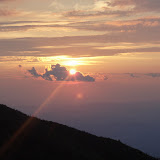
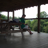
  After nearly two weeks of recuperation, I felt things had improved significantly enough to try a test hike. Kathy and I made a mini-vacation out of it by driving to Twin Pine Camps, outside Baxter State Park. We had a wonderful evening of canoeing on the lake followed by dinner at River Drivers restaurant. The cabin we stayed at was very nice, modern but with a back country flavor and situated right on the lake, which lent itself to spectacular sunrise pictures the following morning. After making a breakfast of omelettes, we set out for the park gate at 7 AM, and on to Katahdin Stream Campground. By the time AT thru-hikers reach Katahdin Stream, they are on their last 5.2 mile section of the trail to the summit. My plan was to hike south 10 miles along the more gentle terrain on the AT to Abol bridge. Kathy and I hiked 4-5 miles together to the Niagara Falls where we had lunch. We saw two fledgling Ospreys in a tree who posed for a photo op. After lunch, we said goodbye as I continued south, and she returned to the campground to drive the car around and pick me up. I briefly hiked with two younger hikers who told me they were just starting a south bound thru-hike. This was late in the year to start a SOBO thru-hike. They had hiked the mountain the day before and were impressed how hard it was to climb. They had good Osprey packs, but all kinds of gear suspended and dangling on the outside. I suspect the hundred mile wilderness taught them what they needed and more importantly what they did not need to carry.
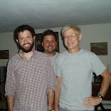
  My hike went well, and the leg and foot felt great. It was a wonderful day to hike though water swelled the streams after a recent thunderstorm. Nesowadnehunk Stream is crossed twice by the AT and a northbound hiker warned me that one of the crossings was dangerous and that I should consider the high water blue blaze bypass trail. I reached Abol Bridge by 1 PM and Kathy arrived shortly thereafter. She found a northbound section hiker who had completed his hike of the AT, and was looking for a ride to Millinocket. There are many opportunities to do a good deed and 'trail magic'. Exiting the woods to Abol, I suddenly heard "Maineiac!" It was Bright Side, a young German hiker I had hiked with in Virginia, along with his brother and Rob. I had last seen them several weeks ago in Daleville ,VA, and here he was about to successfully complete his hike. I was very happy for him.
  The following Sunday, I hit the trail for real from my point of exit at Bromley Mountain. After an overnight in Plymouth MA to see friends, we drove to my daughter's home in Greenfield MA, and stayed the night there. From there we drove to Mad Tom Notch, and I was once again on the AT. Given the ankle swelling issue, I bought a bright pair of athletic compression knee socks, and was planning to use vitamin ' I ', on a daily basis, to try to maintain control and healing of my injury. 
  
Baker Mountain, Vermont
  The first day out, I kept the mileage to a reasonable 14 miles to the Little Rock Pond Shelter. The hiking seemed easy even with the full pack, and two weeks of inactivity. This was a beautiful pond tucked into the mountain. I arrived 30 minutes before the rain started. The rain continued for most of the night with a few thunderstorms as well. The metal roof resounded with the pounding rain at times. Once again, it was a good night to be in a shelter.
  The rain stopped in time for the start of the next day's hike of 20 miles. The terrain was fairly gentle with a few stiff up and downs, but for the most part, the hiking was easy and I felt great. I did run into a young hiker heading south who looked familiar. Then he gave me his story, which was definitely familiar. He told me he was a NOBO, but had to return to the nearest road to get into Rutland to straighten things out with his bank who had 'red-flagged' his ATM card leaving him without any funds. He asked if I had a few dollars I could spare to help him through. Well, I had seen this same hiker, with this same story in Cheshire Ma., two and a half weeks ago. The bank again... maybe he just needed to change banks! As hikers help other hikers in distress, I gave him money then, but now it was obvious that he was financing his AT thru-hike by pan-handling other hikers. I did not repeat my mistake and he went on his way. I warned several south bounders about the scam. Arriving at the Governor Clement shelter, I found only two other women there camping in tents. Unfortunately, I also found that the new sock arrangements had given me another blister under my toenail, the first blister since Georgia.
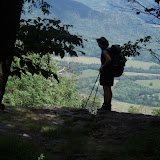
  The next day brought me to the summit of Killington on an especially spectacular day. Once again, the climb was long, over 2500', but very reasonable. I met a couple of groups on top with hikers from a local college out for a day hike. From the summit, I could see the Adirondack Mountains as well as the Whites.
View from Killington
After Killington, I walked the remaining 6 miles to Sherburn Pass and the Inn on the Long Trail. It is a stay hikers love, though it is not know for four star accommodations. It is a room, a shower, great breakfast, and a great restaurant with a bar. I arrived early in the afternoon, and now was seeing more swelling in the ankle. I wore the compression sock to bed that night, and it seemed better in the morning. However I was worried this might mean I was not rid of the injury yet and with the hike, the injury was making a comeback.
  The next day proved to be a fairly difficult day with several climbs over 18.5 miles. It was more clear but humid again and the exertion soaked my clothing. As the day went on, my leg seemed to bother more and more. The next day was especially challenging terrain, with many hard steep climbs. Originally I planned to finish 20 miles, but by the time I reached West Hartford, a small town west of White River Junction, my foot and attitude were done. I spoke to a friend who lives outside of Hanover, and he agreed to pick me up the following day. I was determined that I was going to finish walking the AT in Vermont.
  The next day, I started walking in the pouring rain, which gradually subsided as the morning went on. The hike to Norwich proved fairly easy, and the hike was done by 11:30. My friend Tom picked me up. His four dogs especially liked Wilson, and wanted to get to know him better. I thought this ill-advised, however. Tom got me to a car rental agency and I drove that day back to Bangor with the resolve to finish my hike next year as a section hike.
Ledyard Brige over the Connecticut River

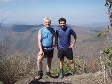
  Two days after my return home, I climbed Katahdin with my son, and his four other of his fit Tufts friends, all former track team members. We did this as a day hike from Roaring Brook, on a trail not part of the AT. We climbed to Chimney Pond, scaled the Cathedral Trail, and balanced across the knife's edge.  This was a harder ascent than the AT/Hunt Trail from Katahdin Stream. The gesture was largely symbolic. These were not the circumstances under which I had hoped to climb the big mountain, but in a way, it felt like the appropriate end to this year's journey.


Sunday, August 14, 2016

Otis, Maine

  I am home in Maine for what I hope is a brief period of recuperation from a bizarre lower leg injury.
Base of Bromley Mt., awaiting pick up and rescue by friends


 I am now almost 5 months into my hike. I have seen hikers with stress injuries, as well as talked with many hikers who knew others who have sustained injuries not unlike elite long distance runners. Injuries can include stress fractures, like heel, navicular bone, metatarsal heads, and even tibial fractures. Other more common injuries include tendon injuries like IT band, shin splints etc. For the most part, these injuries surface within the first 4-6 weeks of long distance hiking. Like training for a marathon, the body then adjusts, even laying down more bone in areas of the feet and legs under stress. Unless you sustain a fall and trauma, it is not common to have these kind of stress injuries this late into a hike. It would seem my right leg missed that memo.
  Kathy dropped me off on the Arlington Road, and Stratton Mt. trailhead a week ago. I had noted two days prior minor discomfort above the right ankle as I exited the trail to be with friends. There may have even been a little swelling over the lower shin, which seemed to dissipate quickly. Resuming the hike up Stratton was no problem. I felt great. The humidity had cleared, and the climb to the top was quite easy. There I once again met the two caretakers, Hugh and Jean, who have volunteered to man the top of the mountain as ridge-runners for the Green Mountain Club for the last several years. I had met them last spring on a day hike with my Williamsville friends. We had a very nice conversation, and saw many thru-hikers pass by on the summit. One of these hikers was Holy Diver, a young Floridian whom I had not seen since Port Clinton, Pa.
View from Stratton summit tower

After lunch and photos from the summit tower, I made my way down the mountain to Stratton Pond where I briefly considered stopping for the day, but decided to push through the last 5 miles to the Douglas shelter. Coming down the mountain, I noted a resurgence of the nagging lower leg 'shin-splints' I had felt two days before.
  By the time I reached the shelter, the pain had increased, and my ankle was quite obviously swollen. That evening, there was a mountain shower which amounted to a downpour. It was another good night to be in the shelter. I shared the shelter with a young couple who were doing a short section hike, and another woman who had started a thru-hike earlier this year, but dropped out due to knee issues. She was now skipping around doing sections of the trail that looked interesting.
  The following day, the pain and swelling were decreased and I was hoping, I had weathered the worst of this and it was resolving. I decided to see how the hike over the next 6 miles went to the crossing of highway, Routes 11 and 30, which drops off the mountain pass into Manchester, Vt. If things were getting worse, I could bail there and call my fiends in Williamsville to be picked up.
View of Manchester, Vt. from Prospect Rocks

 The hike seemed to go well and I felt no worse for wear. I made the decision to push on the next 3 miles of hiking brining me to the summit of Bromley Mountain, which again is a popular ski resort. By the time I reached the summit, the lower leg and ankle were once again swollen and more painful than ever. I felt that I would not be able to push any further down the trail and I would need a substantial break to investigate and nurse the injury back to health. This was not an easy decision for me. Fortunately for me, the mountain runs a theme park on the weekend which includes running the lift to the summit. It was easy to hitch a ride to the base lodge where I consoled my troubles with a large, extra thick, milk shake and called my friends.
  I spent two days with my friends, as Kathy had returned to Maine. I was seen in a local clinic, and an X-ray was done, showing no obvious fracture. As prolonged recuperation seemed needed, I rented a car and returned home to Maine. I have had an MRI which only shows swelling and edema of the Anterior Tibialis muscle, again a known injury with runners, but is relatively less frequent and unusual. I was able to see an orthopedist who specializes in sports medicine. He prescribed rest, ice, ibuprofen and a boot to immobilize ankle flexion for a few days to a week. I will then try a local hike, if this seems to resolve. If that goes well, I may return to Vermont in a week. Time is getting short as I have to return to work by October 3. In the mean time, it's nice to enjoy the lake, and being home with Kathy for more than a day or two.


Friday, August 5, 2016

August 4, 2016   Williamsville, Vermont (near Stratton Mountain)
Crossing Vermont border 

  Another 10 days has passed since the last installment, and the states have been whizzing by. I am home in New England, and have already covered Connecticut and Massachusetts and am 40 miles into Vermont, now taking a day or two off to enjoy the company of friends Deb Luskin and Tim Shafer (not fiends) in southern Vermont, and a visit from my sweet wife Kathy, the first reunion in over two months. I have been enjoying fabulous food in large quantities and swimming in the river nearby. Meghan and Eric were able to join us as well for dinner.

  The hot weather has become fairly reasonable and tolerable since entering the northern states on the AT, and next week apparently promises even cooler weather. We are now once again gaining altitude on our route. Entering northern Mass., I climbed the 3491' Mt. Greylock, the first real mountain since the south and the first time back at a 3000' elevation. I climbed Glastonbury peak two days ago and at 3800', it is the highest elevation I have seen since Virginia. I know that there are higher climbs to come, and much more challenge ahead. I can't help but think that the hiking in the next three states is the climax to the entire AT, culminating in some of the most rugged and beautiful mountains in the entire Appalachian range.
View to north of Stratton and Bromley from Glastonbury Mt.


  Over the last week, I have seen many AT thru-hikers heading south, or so called SOBO's. These folks start their journey on Katahdin in May or June, and head south to finish in Georgia, starting on the hardest and most beautiful part of the AT. Before they have their hiking legs under them, it must be difficult to fully appreciate the mountains around them. At a shelter two days ago, this seemed borne out when two hikers told me how rough and terrible their time in Maine and New Hampshire was, but that they were greatly enjoying Vermont. The last time I did this with Sean in 2007, only 200 or so SOBO's started. This year, the numbers are not certain, but are likely in the range of 500. One SOBO told me that he was informed by a Baxter Ranger that he checked out 100 SOBOs who left in a single day. Again this just points out the tremendous growth of the thru-hike fascination. In 2007, 1000 hikers started north from Springer; this year the estimates are around 5000. What I have seen in Vermont is a sudden over-crowding issue at the camping sites. There are now many competing groups. We have the AT hikers, the NOBOs meeting the SOBOs. The first 104 miles of the AT is also the Long Trail of Vermont, separating at Maine Junction near Rutland, the Long Trail continuing north to the 'Journey's End' on the Canadian border, and the AT continuing to Norwich Vermont to enter New Hampshire via Hanover over the Ledyard Bridge. The Long Trail also has it's share of thru-hikers, usually heading north, section hikers, and weekend hikers. The end result is that one needs to arrive in a campsite by 5 PM or risk the left-over rocky ground to pitch a tent, and no room in the lean-to.
  As I left Kent, I thought for a minute that Wilson had abandoned the mission, and flown the coop. Sunday morning, I ran back to the PO to see if I had left him there while unpacking my 'bump box', only to find the doors locked. Luckily, sports fans, a day later I realized that he had been tossed deep into the pack for safe keeping, and he was later able to join me at photo opportunities at border crossings, etc. It gave me a scare, but all is well.
  I spent one more day in Connecticut, most memorably following the Housatonic River. The river is beautiful, but marred by signs warning fishermen not to eat any fish caught there as they are still likely contaminated by PCB's dumped there by GE in the 60's and early 70's. I negotiated a few more ridges, some of which were easy, others difficult. Just before the exit in Massachusetts, we climbed over Bear Mountain, the highest point in Connecticut at 2316'. There in 1886, a monument of a rock pile was erected with an engraved stone to commemorate this.
  Two days after leaving Kent I slept in Massachusetts after a somewhat rough day. The rain had been on and off leaving the rocks and the trail very slippery. The descent of Bear Mountain was absolutely treacherous. I arrived in the campsite exhausted, and hungry. As I set up the tent, it began to rain again. After throwing all my gear into the tent, I sat outside to cook dinner, only to drop the foil packet and lost half of the contents on the ground. Perhaps I may have salvaged a bit more than I should have, but forest duff only absorbs the flavors around it and provides excellent roughage. Hunger will drive us to do things we might not otherwise do!
  The next day the sun was out, though it was initially very humid as we were greeted in Mass. with two rough climbs up Race Mountain, and Mt. Everett, the second highest peak in Mass. As the day went on, the humidity cleared, and from the second peak, we clearly saw the outline of Mt. Greylock, the first real mountain, and elevation above 3000' since we left Shenandoahs. I was home in New England with the familiar surroundings and mountains!
Greylock in the distance

  My third day in Mass, I made a point of making Upper Goose Pond my destination. The pond is undeveloped and pristine, now part of a state park. AMC runs the cabin as a free hostel and offers breakfast for hikers, requesting only donations for the service. The pond was wonderful, and the swimming magnificent, and worth the 6AM start on the trail to get there. That night, between the 16 people in the bunks in the cabin and tenters, a record 52 hikers stayed at the facility. The caretakers were a lovely couple also from Williamsville, Vt, and know my hosts here well. It is a small world.
Upper Goose Pond


  From there I had a couple of short days staying with a college buddy of mine  who sang with me in the Dartmouth Aires, an acapella group. Brian lives in his home town of Pittsfield. There he practices law but is better known for his singing and theatrics. I stayed two nights there and 'slack-packed' the trail from Washington Mountain Road to Dalton, Mass.

  Nine years ago, I stayed in Dalton with a trail angel, Tom. The trail runs down the sidewalk in front of his house. For years, he has taken thru-hikers in and cooked them dinner, and has charged nothing. I stopped in again and found him home. After explaining who I was and my connection from 2007, I thanked him once agin for his kindness and wonderful service to the hiking community. He told me though that he had to take his name off the ATC list, as the last couple years had brought him hikers from the party element, who carried on, drank, and disturbed his neighbors. I noted with him that this indeed was a dramatic change I had seen in some of the hikers now when I compared things now to the experience in 2007.
  Brian put me on the trail in Dalton the next day with the intent of reaching the summit of Greylock and the Bascom Lodge. My digestive tract however, had other ideas, and demanded frequent off trail views. By the time I reached Cheshire, I was nauseous and felt dehydrated. To make matters worse, the church hostel in the town had just closed for 2 days of renovations. After pondering the universe a while, I called my wonderful daughter Meghan who lived 40 miles away in Greenfield. She came to the rescue. The plague seemed to be a 24 hr thing, but I stayed the next day for insurance (also to avoid getting wet as it rained with a vengeance all day long!) As the original plan had included hiking down Greylock with my nephew Mesfin, we instead got together with he and my sister-in-law and went to the new Star Trek movie, then to a Mexican restaurant. This proved far superior to getting wet in the rain.
  Meghan dropped me back in Cheshire the next day for the long climb up Greylock. I arrived on the foggy summit in the rain. The lodge was nice and the dinner fantastic. Unfortunately, the bunk room was full, and I spent the hot night feeling like a sardine in the small room with 16 other people, only one of which was a thru-hiker. Most of the others had arrived by car.

Bascom Lodge


  The next day once again started on a wet note, but improved as the day went on. Water seemed to be cascading down the mountain and trails as I left, and it took me almost 3 hours to cover 6.2 miles. Things dried up a bit by the time I reached North Adams. From there, it was a short 4.2 mile climb (up) to the Vermont border and my next state.
  Vermont has been great, though the trail has had significant mud to negotiate. With the higher elevations, I have seen the familiar tree changes, lacking in the south. There is now a clear change to sub-alpine firs and balsams. It's nice to hike again through the whispering pines!
  The hope is with a return to trail tomorrow and 120 miles in Vermont to go, that I'll cross the Connecticut River in 7-8 days. From there, I hope to finish New Hampshire by the end of August, leaving me the month of September to enjoy my home state of Maine!


Saturday, July 23, 2016

July 23, 2016   Kent, Connecticut
On the Connecticut Border

  Well, we have finally come home... home to New England that is. After almost 1500 miles of walking from Georgia, I have come far enough to see the skyline of New York City. Since my last entry, it has been hot. I have tried to make a somewhat expedited passage of the middle Atlantic states as a result. Last night, I camped on the shores of the Housatonic River, and made the final 8.5 miles here today, starting my hike at 6 AM, arriving at 9:30, in order to avoid the heat of the day. I also wanted to get to town early enough to do all the chores of laundry, food shopping, stopping at the outfitters, and I still found time to use the computer at the library to catch up.

  Crossing the Delaware was interesting, following a pedestrian way linked to I-80. The bridge actually swayed as some of the larger trucks rolled by. I kept encouraging the bridge to last long enough to allow me safe passage. George Washington standing in a boat, and any other thought was pretty much wiped from my mind by the decibels that highway was raining upon my eardrums.On the other side, we entered Worthington State Park and New Jersey. About 4 - 5 miles of climbing later, I reached Sunfish Pond. The sign tells us this is the first glacial body of water we will encounter heading north, as this point marks the farthest south the glaciers reached. Of course, the sign also warned us not to go swimming, a warning seen by thru-hikers as a suggestion only, usually to be ignored. The ridges in NJ were different: They were much more open with sparse trees and grass. Views were good, particularly of incoming thunderstorms which caught me in a deluge the second day in. Thunder and lightning on an almost open ridge can be a terrifying event.
Passing thunderstorm

  Appalachian Mountain Club out of Boston has a presence down here operating the Mohican Center, right on the trail. You can camp here, for a price, or rent a cabin. They will also make sandwiches and sell small hiking accessories. Nine years ago, Sean and I stayed at a YMCA camp on a lake, just off the trail. I asked the AMC director if she was aware of any camps allowing hikers to camp. She pointed to a small lake on the map, but said it was owned by SCA now, but often would let hikers stay. When I arrived at the camp, I realized it was the same place we had stayed nine years ago. The Park Service now owns the property, and has contracted to have many of the buildings restored. I was a little chagrined to find out that the camp was a BSA camp in 1971, at which time they had added copper sulfate to the water to eliminate some pest or algae. The water is still sterile to this day, but brilliantly clear. I stayed in an old Todd Lodge built in 1938 with beautiful woodwork, again being restored, and found a painted map on the wall of the old 1971 BSA camp.
  At the camp, I initially left doors and windows open, only to discover swarms of mosquitos after dusk. This was actually the first time this pest has shown it's presence. The three state of Pennsylvania, New Jersey and New York have been very dry, so the presumption is this has kept the suckers' numbers at bay. (Trail Angels have been wonderful, leaving water by the sides of roads or at the shelters.) Up till now, we have experienced gnats, which are a  close relative to the Maine black fly, our state bird. The southern variety do not swarm in great numbers too numerous to count as in Maine, but a few can constantly hover around your face if you are walking, and can then suddenly dive bomb into an orifice like the nose, mouth or ear canal. Their bite is just as reactive as the Maine black fly, and they don't seem to have the short season we have in Maine, but remain active and alive for the whole summer. The purpose of dive bombing remains obscure. On two separate days in Shenandoah, Meghan received a fly bomber in her eye. I initially offered surgery with tweezers and a scalpel. She sought a second opinion, and we eventually agreed upon removal of the buggers with tissue paper. I often think of the Star Wars movie, ' you've got to drop the bombs in the reactor core to blow up the Death Star'. If my head blows up someday, I'll know the gnats were successful. Then we have deer flies, about the same as the ones in Maine, but with one critical difference: they can go on silent running, and occasionally land without detection. The final pest down here, and one with potentially much more serious consequences, is the deer tics, which can harbor Lyme Disease. Having contracted this on my first thru-hike, with no serious consequences, (treated 4 months after the fact), I wanted to take no chances this time around. I have frequently sprayed my clothing with permethrine. Without any scientific basis of fact, I also use my poles to disturb grass and brush in front of me, knowing that they are sensitive to movement, and cue their drop to it. Using the poles out front, I am hoping the tics will fall where they may, preferably not on me.
  The middle Atlantic states have also allowed me to forage for food off the AT. At any particular road crossing, there is greater than a 50% chance that a deli or bar is within a half mile walk. This lessens the necessity of carrying ones lunch, and sometimes dinner. Most deli's in NJ are excellent. With the hot weather, I have also made a few more overnight town stops. I stayed in a church hostel in Vernon, NJ. The next day, I crossed the long rock ridge, and the NJ/NY border in the heat of a 90' day.
I ended up at the end of the day once again in Greenwood Lake, NY, where I enjoyed a swim in the lake and a good meal in town. Since entering NY, the terrain has actually been much harder. It began with the Bellvale Mountain traverse, which required us to also do a lot of bouldering. The next day, we came down a stretch, fondly referred to as Agony Grind. Most of this is managing to walk through large rocks without falling. It's like I can hear, 'eh, it's New York...get outta here!"
  Entering Harriman State Park was once again a treat. It did start with another powerful thunderstorm, which I was largely able to weather under the narrow roof of an information kiosk in a parking lot... right next to the couple in the huge RV, who did not seem interested in sheltering a hiker from the storm, but did find time to walk the three dogs in the storm. After that passed, I walked the short distance to Island Pond, a camping and swimming spot we had used 9 years ago. The site did not disappoint and the evening was great. I went to bed with no other tents around, and awoke in the morning to see 5 other tents and a hammock. They explained they came across Trail Magic at 6:30 PM, so they could not run out and be rude, ...so they just had to night hike there...SS,DD.

  The following day I traversed the park to Bear Mountain, then down to the zoo. On the summit of Black Mountain, we clearly saw the New York skyline for the first time.  The trailside zoo actually contains the lowest point on the AT by the Bear Exhibit at 121' above sea level. Sean and I had missed this last time as we arrived after closing. David, my brother-in-law, met me at the bottom, and brought me back to his home for the night. He cooked dinner, and even did some food shopping for me prior to my arrival. He was a true trail angel. Traffic pattern was quite complicated that evening as the Tappan Zee was closed due to crane collapse, and it was grid-lock over Bear Mountain Bridge as a result.
Summit of Bear Mountain

Bear exhibit, Trailside Zoo, lowest point of altitude on the AT; 121'
Bear Mountain Bridge

  David dropped me off the following morning at the Inn, and we crossed the bridge on a spectacular morning. Again, mostly because of water issue at the shelter sites, I aimed to stop at Fahnestock State Park in NY. I arrived at 6:30 after a long day. There, trail angel Joe was preparing free dinner for all hikers, almost 30 in all that night, consisting of an egg, cheese and ham sandwich. Ladies got pie or pastry. He had been doing this several days a month during hiking season for over 10 years. I asked him why and he told me he had been family camping there 10 years ago and saw a guy with a pack go up and down the road in front of him waving 3 times. He waved back. He later saw the hiker the next day and asked why he had gone by so many times, and it came to light that the hiker was hoping for an invitation to dinner. Joe felt terrible he had not seen the cue or invited him in. Prior to that, Joe knew nothing of the AT or thru-hikers, but has been paying it back for these many years. He provided the same meal from 5-9 AM the next day to us as well! As an aside, the water in the park was also not potable as a large stockpile of roadsalt had leached into the aquifer, rendering the was not potable.
  The AT through this corridor may look like wilderness, but at times does not sound like it. We have had to cross such busy roads as the NY Thruway, the Taconic Parkway, and I-84. You can hear those trucks for miles. At Telephone Pioneers shelter, not only was the water source dry, but the more dependable source a mile earlier was also dry. I had to get by on minimal water for the night and went to bed thirsty. There I met Blue Turtle, a 70+ German thru-hiker. She called herself a turtle because she thought she was slow, but in fact, her start date was March 22, and from what I could see, she could put the big miles down as easy as the youngsters.I started sleeping in the shelter, but the mosquitos got so bad that I got up in the night, and set up my tent and then moved sleeping quarters. We have no water, but still have bugs... where is the justice!
  Last night, I pulled a short day after entering Connecticut. Entering New England was emotional for me, as this was finally home, within short reach of family and friends. I camped on the shores of the river, and cooled down with a couple swims. We again came across another nice gentleman, John, and his friend grilling hot dogs and hamburgers by the side of the trail The generosity of people to perfect strangers hiking on the trail is really remarkable.
  I roughly expect to go 9-10 days before entering Vermont, and there will once again find real mountains. I plan to stay with fiends in southern Vermont, and perhaps Zero there, affording me yet another opportunity to add to this blog. Till then, happy trails!
Housatonic River, Ct.


Wednesday, July 13, 2016

July 13, 2016     Delaware Water Gap, Pennsylvania
Delaware Water Gap and Kittatiny Mountains

   Well 270 miles have passed since my last blog entry, mostly due to lack of internet and computers in the small towns I have stayed. Tomorrow marks a momentous occasion however, the end of the AT in Pennsylvania, or as it is fondly known to thru-hikers, 'Rock-sylvania'. Tomorrow my hike begins anew; New Jersey, New York, and New England which includes New Hampshire. With any luck, I hope to be in my native New England with entry into Connecticut in 8-9 days. The heat and humidity are here of course, and this has motivated my rather rapid transit across Penn's Woods.

    Because of my upbringing with hiking in New Hampshire in the White Mountains, however,  the rock experience was not all that bad. I had one day in the rain where the rocks were very slippery, and I fell twice in an area of larger rocks. Pennsylvania however has different rocks for different tastes. Most of the time, the path has small to medium sized rocks, which can roll when stepped on. Oddly, there frequently were plate sized flat rocks set firmly on edge in the soil which can rip and tear at boots, (I bought shoe-goo today today fix my boots, where the rocks had peeled back the toe piece) , etc. One gets to love stubbing your toes, or hitting your heal on follow through which can send you into a spill. These rocks are very unlike New England. This slows you a bit, but you can still maintain a relatively fast pace while playing hop-scotch. The areas of larger boulders were found at overlooks, like Bear Rocks, Bake Oven Knob, Knife's Edge, and the Pulpit. These were relatively short lived, and consisted of car sized rocks, necessitating hopping from rock to rock with a 30 pound back-pack on, testing your skills of balance and strength. I heard a lot of whining from hikers about the rocks, but I think that hiking and growing up in New England prepared me well for the experience.
   The other interesting development is the thinning of the thru-hiking crowd. We have heard of a somewhat mass exodus of hikers after Harper's Ferry. In general it seems that the shelters and campsites are not as crowded, and I see less of the 'party-crowd' of hikers we saw frequently in the south.
   I left Harper's on June 28, facing the short 40 miles in Maryland. The trail crossed the relative wild white water of the Potomac River, over a walkway connected to a railroad bridge. For 3 miles, it follows the tow path for the old C+O canal. Most of the canal is overgrown but there is still water in some sections, mostly enjoyed by ducks. The hiking is fairly easy through the state compared to the trail in Virginia. Much of the trail follows old logging roads through beautiful hardwood forests, something I was not fully able to fully appreciate  nine years ago, as the trees then had been defoliated by an infestation of Gypsy Moths. The trail goes through several parks in Maryland and south Pennsylvania. Many parks had concession stands, and as you know, when you find an opportunity to forage for food directly on the trail, you should do so! The AT can provide wonderful hot dogs, french fries, and ice cream if you know where to find it.
   In Maryland, I passed the first Washington Monument, a great stone tower originally erected by the local citizens in tribute to Washington. It has been struck by lightning and apparently destroyed several times, but always rebuilt and is now a state park. The second day out, late in the day with a 23 mile hike, I crossed the border into Pennsylvania.
   Southern Pa. is actually very nice, and has almost no issues with rocks. Again the park is routed through many state parks. Hiking becomes largely a ridge walk with very little up and down for distance up to 40 miles. This is truly the 'green tunnel'. It is beautiful in it's own right, but at the same time can become monotonous mile after mile. For hours on end, there may be no view, no other hikers, and it's just you, your thoughts, and the trees.  It is however a time for introspection and realigning one's priorities. The terrain was easy enough to allow me to extend my hiking distances. Much of the time, my hikes were 18-22 miles, but I have also completed several 25 mile days and seem to be none the worse for wear. At Pine Furnace State park, I watched a few of the hikers attempt the half gallon challenge, by eating a half gallon of ice cream as fast as possible. I enjoyed some fries and a milk shake only, then took a cooked burger to go, to be consumed as my evening meal. That was the best!
Boiling Springs; water is 55'!

   I stopped in Boiling Springs, Pa overnight after a 12 mile hike into town. We stayed at the Allenberry Inn, a no frills luxury resort on the auction block this July, complete with a golf course. My room had a TV that received all of 4 channels,  one of which was the shopping channel and another Me-TV. They claimed to have WiFi, but I could not seem to sign on. I spoke to the desk clerk who said she would have someone check it out....right. I stayed the night in Boiling Springs, which is not boiling, but a fast flowing spring producing a million gallons of water a day, at a temperature of 55'. In the late 1800's, the townspeople created a man-made lake from the effluent in the middle of town as a center-piece of the town for enjoyment and recreation. I noticed several people still come to the shore to fill water jugs to take home.
   At the Allenberry, after paying the $4, they gave me a detergent pod, and told me where the machines were to do laundry. After a complete cycle of wash and dry, I brought the clothes back to the room, and noted that my shirt still smelled terrible, like it had never been washed. It was then that I noticed the detergent pod had survived intact both a washing and drying! Back to washing machine it went, this time manually puncturing the pod.
   After a good night's rest, I set out on the trail again, crossing the Cumberland Valley. for nice flat 12-13 miles through corn fields and pastures. With the flat terrain, I was able cover the first 7 miles in 2 hours.There were two climbs late in the day that brought me to Cove Mountain shelter, some 3 miles from Duncannon.
   The next day, July 4th, I reached the town of Duncannon early, only to find most stores closed for the holiday. The town has seen better days and is still run down with a lack of buisnesses in the downtown. I had met two nice day hikers at the shelter, who also down-climbed to the town. They drove their car around until they found me, then brought me to the local market for resupply, and waited till I was done. They then dropped me back in the down town area. I was planning to stay at the Doyle Hotel overnight, famous in AT legend and lore. It was built at the turn of the century by Anheisser-Busch, but it too had seen much better days. For $25, its a room, a bed, and a shower. I technically did not sleep in the bed as I chose to use my sleeping bag on top of the bed. I had to check in the morning after a somewhat restless night as I was convinced they had put two box springs on top of each other only. On inspection however, the mattress was just very bad, thinned to the point you could feel every coiled spring.  While showering,you have to ignore the large holes in the bathroom ceilings. They do however still have a great bar and restaurant downstairs.
the Doyle Hotel

   This fine establishment however was not open till 11 AM, so I found myself at the home of Trail-Angle Mary, who was serving a free breakfast to hikers. She is a woman of very modest means, who gives of herself to any and all hikers. She told me that several years ago she found herself homeless, and was forced to camp at the town campground frequented by hikers. It was there that she first learned of the trail and the hiking community. She got to thinking that hikers must have electrolyte problems, so she would go to Walmart and buy bananas, then distribute them to the hikers.  Her association with the annual hordes of hikers from that point on is apparently history. I was very impressed how she could give so much and have so little herself. She was very inspiring.
Trail Angel Mary

   At the Doyle, I tried to use their computer to update the blog. It looked like something out of the 80's, and I could not get the browser  to boot up... neither could the owner. About my age, she made some comment about how some things with age don't get better. I have to agree. Sorrento's Italian Restaurant was the only establishment open that night, Though I knew I should have ordered the small 12" pizza, I ordered the medium 14", and even surprised myself by eating the entire thing. I need to put a check on this when I get home.
   The next few days were quite hot and humid, which always seems to slow your progress. I still managed to put in 22-24 mile days despite the heat. The ridges so far were not bad with rocks, but we knew the rocks after Duncannon were famous with hikers. From the last hike, I had remembered the 501 shelter, a shelter just off Pa. route 501. The caretaker lives next door, and there is a cold shower. In hot weather, this is a welcomed perk. Also, because of its proximity to the road, several eating establishments in the local town of Bethel offer delivery to the shelter, and have been known to pick up hikers so they could shop for necessities in town, like beer.  We did order a calzone which looked a lot better than the dehydrated beans and rice I had brought along. You can forage off the AT!
   After 3 more days on the trail, I did a short 9 mile day into Port Clinton and the Port Clinton Hotel, needing a small resupply, and greatly needing another shower. The hotel was clean, but old (like me). At least each room had a TV, and the bar and restaurant downstairs were good. We visited the barber shop which encouraged hikers to drop by, charge their devices, have coffee and cookies. It was there that I found a ride down the pass to Hamburg to the local Walmart, and Cabella's, the largest one in North America. Cabella's is an interesting place to look around but is not geared to hikers, unless they hike in camo. After Walmart stop for food, I walked most of the 1.8 miles back, in a light rain, on a busy highway, until a trail angel pulled over and gave me a ride the rest of the way. He dropped me at the barber shop, as I felt a trim was in order. Unsolicited, this gentleman told me that men would come from miles around to get their hair done here. This sounded like a great idea... at first. I was seated with the older of the two barbers, who as it turned out was the other barbers father. He asked me if I could guess his age. I figured 70-75, but thought I'd be nice and low-ball the estimate to 65. He laughed and told me he was 90! His son who looked 50, was 69. Anyway I told him I just wanted a little trim. He then brought out the electric shears, and I suddenly knew what sheep must feel like every spring. With the first pass, the 'damage' was done, so I had to let him finish. When done, he showed me with great pride my 'new look'. He told me he was actually an artist, and when someone walks through the door he can see in his minds eye what that person should look like. Ah well, it's just hair and it will in part grow back... someday. For the time being, it's optimal for the hot and humid weather ahead! I think this cut will last me the duration of the hike. I do not anticipate purposefully recreating this look in the future.

   After the brief lay-over, it took me 4 days to reach my current location at Delaware Water Gap. During that time the heat and humidity cleared, and the hiking became a pleasure. The first day out of Port Clinton marked the passage of the front with on and off showers. We did get fairly soaked over the course of the day, and fell twice on two areas with large rocks. Wet Lichen on rocks and boots do not mix! After reaching the shelter, a violent thunderstorm went through. It was a good time to be in a shelter.  
    We had heard that there was a bad stretch of rocks spanning a 5-6 mile distance from Wind Gap to Wolf Rocks. Once again, the New Englander in me said no problem. During this stretch, I met another older thru-hiker 'Granite State' a hiker from Dover, N.H. We also climbed Lehigh Gap. This was our first boldering experience on the trail, not unlike parts of the AT on Katahdin before the Gateway. This did terrify some hikers. Beyond that, we passed through a four mile super-fund clean-up site. The area was completely devoid of all vegitation 9 years ago due to years of smoke pollution by a zinc smelting plant in Palmerton, shut down in the 1970's. I was surprised how much greenery there was that had developed since my last visit.
Lehigh Gap

   The descent into Delaware Water Gap did offer some spectacular views of the river and the Kittatiny Mountains in New Jersey. I cross the pedestrian bridge on I-80 tomorrow into my next state. Next update will likely be from Connecticut, after 160 miles.

Friday, July 1, 2016

Hiking with Dad

Hi there, Meghan here, guest blogging!

Contents of my pack
When my dad decided to hike the AT for a second time, I couldn't understand why he felt he needed to lace up his boots and hike 2,200 miles again. So, I decided to find out for myself by hiking the 110 miles from Waynesboro, VA to Front Royal, VA in Shenandoah National Park with him. Unlike my brothers, the longest backpacking trip I had ever endured was approximately 20 miles, when I hiked the Routeburn Track in New Zealand almost 10 years ago. But, feeling strong and fit from my recent half marathon training, and having nothing better to do besides binge-watching Nashville (#summervacation), I gathered up exactly 25 pounds worth of critical belongings in my brand new backpack, and set off with my dad from Rockfish Gap.

Mile 0
A friend met me in Charlottesville and drove me to Waynesboro, where dad had gotten quite comfortable with B&B life, but I could tell he was excited to get back on the trail.

The first day was a "short" day, only 8 miles from Rockfish Gap to Calf Mountain Shelter. Little did I know that by the end of trip, yes, 8 miles would, in fact qualify as a short day. The terrain was gradual, and the trail was gentle. I couldn't believe how AMAZING my feet felt. Little did I know how quickly and drastically life below the ankles would change. More on that later.

We stayed the night at Calf Mountain Shelter with 20-30 other hikers. Luckily, we got out early enough so that we were able to secure spots in the shelter. I was a little nervous because in shelter log there was a big announcement from an earlier hiker: CAUTION!! LARGE BLACK SNAKES LIVE UNDER THIS SHELTER!! Dad, the optimist that he is, reminded me that snakes eat mice, so we wouldn't have to worry about rodents. In my world, however, mice > snakes, so yeah, I'll sleep on the top bunk, thank you very much. Can you even call tossing and turning on and ultralight ThermaRest sleeping? Also, did you know that ultra light = ultra thin? Also, how many times can your arms completely fall asleep in one night before you risk permanent damage?
Hanging food bags at Calf Mt. shelter

Day 1 Takeaways: hiking = awesome; living on the trail...questionable.

The second day on the trail we hiked 13 miles from Calf Mountain Shelter to Blackrock Hut. I definitely lost steam close to the end; the last uphill was torture, because at some point in the day, my feet developed about 6 blisters in various locations. There, we met a few other hikers, several of whom we would see here and there throughout the trip--BearSaw, Fire Feet, Ham Fist, Signpost, and Pace, to name a few. The backpacking meals I made from dehydrated vegetables, beans, and rice were awesome! I adapted the recipes from this blog to make them plant-based.

We got a big rainstorm that night, and I met my first thru hiking dog, a golden retriever named Dexter.

Wilson protecting our food from bears.
Notice the claw marks?
Day 3 we hiked 7 miles from Blackrock hut to Loft Mountain Campground, where we were able to drink a beer, get a shower, and eat fries and milkshakes from the Wayside. We got a ride down to the Wayside from a ranger and tried to hitch the 1.5 mile uphill walk back to the campground, but nobody would pick us up. My feet were pretty tender at this point, with more blisters popping up in the weirdest of places, including underneath my big toenail. I bought some cotton souvenir bear socks to give my toes some more room in my shoes, because my hiking socks were too thick, which was contributing to the blisters.


Beer!
 Okay so by this point, we're almost 30 miles in. I'm beginning to understand that hiking the AT is the ultimate test of willpower, determination, and strength, and if my feet would just cooperate, I think I could actually get into this. Can I hike in my flip flops?

The next day we hiked another 14 miles to Hightop Hut, and this day, my feet are the absolute worst. I don't want to complain, but every. single. step. is excruciating. I wondered if I'd make it. And then I met the world's original ultralight backpacker, an ancient, adorable lady who slept on a foam pad with a fleece blanket and no pillow. Ok, so if she can hike, I can too, right?


At Hightop Hut we met Tough Love and his thru-hiking pup, Freddy Love, who we would slingshot with for the remainder of our trek through SNP.

Feeling it now! 

Leaving the hut the next morning, we had incredible views from the top of Hightop Mountain and then, after just a few miles of hiking, we came across TRAIL MAGIC! This was amazing: they had everything from beer and sweet tea, to sloppy joes, hummus and veggies (YAY) skittles, bandaids, and camp fuel. We sat and socialized with other hikers and the trail magicians (is that what they're called?) for a bit before heading to Lewis Mountain Campground, which was an 11.5 mile day. We got another shower, and some beer at the campground, and we shared a site with Big Heart, Bear Saw, and Fire Feet. The camaraderie on the trail is really something special.  When I asked Bear Saw what he does when he's not backpacking he answered something along the lines of being a "salesman of alternative investments," to which I responded, "so you're a drug dealer?" I still don't know what he does.
View from Hightop Mountain
Father's Day Dinner at
Big Meadows Lodge
Big Meadows Campsite


From Lewis Mountain camp we hiked a short 7 or so miles to Big Meadows Campground, where we had sodas and SALAD for lunch at the Wayside. Oh man, iceberg lettuce never tasted so good. We did laundry and had another shower, and the nice lady at the camp store gave me ice for my toe with the blister underneath it, which at this point, was causing some serious swelling. We had a belated Father's Day dinner at the Big Meadows lodge, because, after all, backpacking in SNP is actually more like glamping at times!

The next morning, we headed out with thunder rolling in. Our first destination was Skyland Lodge, where we would have lunch before heading on to Byrds Nest 3 shelter, a 14 mile day in all. We were about a mile from Skyland when we got caught in the first big rain of the day. We hiked quickly and got inside before we got too wet. We had a good lunch at Skyland as we watched a huge thunderstorm bring with it nearly horizontal rain. When the rain stopped, we paid our bill and hit the trail. We didn't get more than a half hour before another thunderstorm rolled in, absolutely soaking us. The first half hour of the storm was fun and exhilarating. But when the rain didn't stop and the trail became a stream, it got a little old. After about an hour of heavy rain, it stopped and we were able to pour out puddles from our shoes, wring out socks and shirts, and hit the trail again.

My feet are ruined. 
Backpackers at Skyland
The hike to Byrds Nest 3 
We arrived at Byrds Nest 3 Shelter right as the next big storm hit. I nearly ran the last mile, as thunder rumbled in the distance. Watch the video to see how intense the storm was! We were lucky to get a spot in the shelter, which we shared with some interesting characters, one of whom left an OPEN packet of cooked food INSIDE the shelter when he went to sleep. I can't believe we didn't get a visit from bears.
Our friend Big Heart had to negotiate with a mama bear to get water at the shelter; she was pretty sure that spring was for her and her babies, but she eventually let him full up his water bottles. I was bummed I missed this!

Trail Magic Cocktail after
18 Mile Day
From Byrds Nest 3, we hiked 18 miles to Gravel Springs Hut. This was our longest day, but we built up to it well. My feet were still a mess, but they were under control well enough to do it. A little "vitimin I" (ibuprofen) really can change your perspective on life, I'll tell you what. Plus, we got blackberry milkshakes at the last Wayside at Elkwallow Gap, and took a nice long break before trudging on.
View From Hogback Mountain 

Our final day on the trail was a 14 miler, from Gravel Springs to Front Royal. We had some incredible views from the top of Marshall Mountain, plus with all the rain, my favorite salamanders, Red-Spotted Newts were out and about.

Marshall Mountain 
Adorable eft

View from Marshall Mountain


are we done yet???


I pretty much hit my threshold with 5.5 miles left, but dad listened to me whine and waited while I ate M&Ms to get me through, just like the good old days.


We exited the park but we weren't out of the woods just yet! Front Royal was still a few miles away.

We hit some trail magic a quarter mile from the end, and this local brew couldn't sum up my sentiment about finishing the hike better: freedom from the trail was certainly not free! It cost me my feet (kidding...sort of).


So, 9 days, 110 miles, 15 blisters, 5 thunderstorms, 3 bears,  2 snakes, and countless mountain peaks and gaps later, we arrived in Front Royal, VA.
Entering Front Royal after 110 miles on the AT


I know I complained a lot about my feet, but in all honesty, my feet were the ONLY bad thing about this trip. Everything else was totally and completely amazing.

I have so much respect and admiration for my dad, who is putting himself to the test to complete this trek. I'm sure with the right boots I could do it too.

I was sad to say goodbye and watch my dad trek on. As ready as I was to chuck my boots in a dumpster, give Eric a big hug, and snuggle the cats, there was definitely a part of me that wanted to keep on going. I was warned by a hiker at the beginning of my trip that this would happen. My trail legs were strong, my endurance was peak, and keeping company with my dad was really great. The trail is a really special place. You hike, one step at a time, mile after mile, day after day, and even though I was only there for 110 miles, looking back and seeing what I've accomplished--what my body is capable of doing--is incredibly powerful. I'll see my dad again in Massachusetts in 6 weeks or so, until then: happy hiking; may the trail magic be forever in your favor!

Life in the Green Tunnel

Heading home on the train from Harper's Ferry, VA
Dad hiked through here 3 days after I left